Eleanor Mann Park

Eleanor Mann Park sign

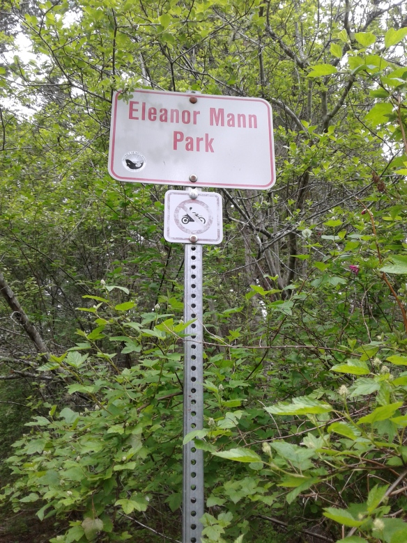
Eleanor Mann Park is in the District of Metchosin, a coastal community in the Capital Regional District of British Columbia.   This forested area was selectively logged in the mid nineteen hundreds and continues to support cedar, Douglas fir and arbutus trees. Salal, ferns, mosses and lichen form part of the understory. The Mann family business, Don Mann Excavating Ltd, donated the parkland in the memory of Eleanor, wife of Don and mother to Steve, current proprietor of the family business. The main trails are bridle trails that are interconnected to the pathways from the end of Sweet Chestnut Place, along Liberty Drive and near the end of Arden Road.   Metchosin Wilderness Park, Bob Mountain Park and Buckbrush Swamp Park are nearby.

Geographical location N48º 22’23” W123º 34’ 48”

Eleanor Mann Park can be reached from the TransCanada Highway (Hwy 1) when you exit at the Millstream /Veteran Memorial Parkway exit. Head south along the Veteran Memorial Parkway to reach Latoria Road. Turn right onto Latoria Road and continue along to reach Happy Valley Road. Turn left onto Happy Valley Road then right onto Rocky Point Road. Continue along Rocky Point Road to reach Liberty Drive. Follow along Liberty Drive to reach Deer Park Trail and look for the park access at the end of the road.

Buckbrush Swamp Park


Buckbrush Swamp Park is in the District of Metchosin, a coastal community in the Capital Regional District of British Columbia. The rough well-trodden footpath circles around a small wetlands area and is about five hundred meters long. Sections of the pathway double as a bridle trail while no deer were spotted during my reconnaissance there is plenty of evidence that deer visit this parkland. The forest and wetlands are composed of deer fern, bracken, grasses, lichens, willows, hemlock, Douglas fir, western red cedar, alder and bigleaf maple trees. The park is across the road from Metchosin Wilderness Park and close to Bob Mountain Park.

Geographical location N48º 22’ 16” W123º 35’ 0”

Buckbrush Swamp Park can be reached from Highway 1 when you exit at the Millstream /Veteran Memorial Parkway exit. Head south along the Veteran Memorial Parkway to reach Latoria Road. Turn right onto Latoria Road and continue along to reach Happy Valley Road. Turn left onto Happy Valley Road and then right onto Rocky Point Road. Continue on Rocky Point Road to reach Liberty Road. Turn right onto Liberty Road and look for the park on left near Eagle Point Road. Buses travel along Happy Valley Road.

Devonian Regional Park

Devonian Regional Park is in the District of Metchosin, a coastal community in the Capital Regional District of British Columbia. This ocean front park was acquired from the Devonian Foundation Alberta, formed by the lawyer, oil man and philanthropic Eric Harvie, and the provincial government in 1980. It is one hundred and thirty five square kilometers of forest area with Sherwood Pond providing a wetland oasis amongst the Douglas fir and Garry oak woodlands. The kinglet, great horned owl and pileated woodpecker might be sighted in the park. This wildlife sanctuary is tucked into the gently rolling landscape between Metchosin farms. A bridle trail lies along the southern perimeter of the park. There are parking and picnic areas. Sherwood Creek flows into the pond and acts as guide for the well-trodden footpaths. The Douglas fir and arbutus trees in the park can be explored by strolling along the gravel trails. The main trail leads through the forest about twelve hundred meters to reach the cobble and pebble Taylor Beach that lies on Parry Bay. The beach overlooks the Strait of Juan de Fuca and the Olympic Mountains. Witty’s Lagoon can be reached by strolling along the water eastward along Taylor Beach. The distance is about six kilometer round trip. Taylor Green Space is about five hundred meters eastward along the waters edge. At the park entrance is a small parking area with toilets. Benches can be found in this park too.

Geographical location N48º 21’ 57” W123º 32’ 32”

Devonian Regional Park can be reached from Highway 1 when you exit at the Millstream /Veteran Memorial Parkway exit. Head south along the Veteran Memorial Parkway to reach Latoria Road. Turn left onto Latoria Road and continue along to reach Metchosin Road. Turn right onto Metchosin Road and watch for the signs to Witty’s Lagoon Regional Park. Continue along Metchosin Road past the junction with Happy Valley Road. The name changes to William Head Road. Continue along until you see the signpost for the park on the left. There is small parking area. City buses travel along Metchosin Road.

Lombard Green Space

Lombard Green Space is in the District of Metchosin, a coastal community in the Capital Regional District of British Columbia.  Lombard Green Space hosts forty-four Lombardy poplar trees  (Populus nigra x trichocarpa ) that were planted in the late eighteen hundreds. These trees were planted in 1877 by Mr. Hans Lars Helgesen along the drive that led to his family home off of William Head Road. A heritage sign stands beside the street sign marking the significance of this green space. A foot and bridle path lies along side the roadway. These row trees are an exotic species that get their name from the Lombardy plains in Italy. The trees were introduced into the United Kingdom and eventually to Metchosin to enhance the landscape of the farm estates of the new residents. This poplar has a grey to green bark which becomes thickened and blackened with furrows as seen on these older trunks. The triangular or diamond shaped leaves are bright green and help to form a windscreen in this farmland area. Taylor Green Space, Weir Green Space, the Galloping Goose Trail – Metchosin and Weir Green Space are nearby.

Geographical location N48º 21’ 59” W123º 31’ 57”

Lombard Green Space can be reached from Highway 1, the TransCanada Hwy. Exit at the Millstream /Veteran Memorial Parkway overpass and head south along the Veteran Memorial Parkway to reach Latoria Road. Turn left onto Latoria Road and continue along to reach Metchosin Road. Turn right onto Metchosin Road and watch for the signs to Witty’s Lagoon Regional Park. Continue along Metchosin Road to Lombard Road. Turn right onto Lombard Road with caution as the road is narrow between the rows of trees. City buses travel along Metchosin Road.

Rocky Point Road Green Space

Rocky Point Road Green Space is in the District of Metchosin, a coastal community in the Capital Regional District of British Columbia. The bridle and pedestrian trail borders along north side of roadway and is one of many such roadside trails in this community. The dirt and gravel footpath is about one thousand meters long and connects Happy Valley Road with Winfall Road. The Galloping Goose Trail and Witty’s Lagoon Park are nearby.

Geographical Location   N48º 22’ 55” W123 32′ 17″

Rocky Point Road Green Space can be reached from Highway 1 when you exit at the Millstream /Veteran Memorial Parkway exit. Head south along the Veteran Memorial Parkway to reach Latoria Road. Turn right onto Latoria Road and continue along to each Happy Valley Road. At the junction with Rocky Point Road turn onto right onto Rocky Point Road. The bridle trail is on the right and can be access from Winfall Road. There there is limited parking along Winfall Road. City buses travel along Happy Valley Road toward Metchosin Road.