Midland Circle Green Space

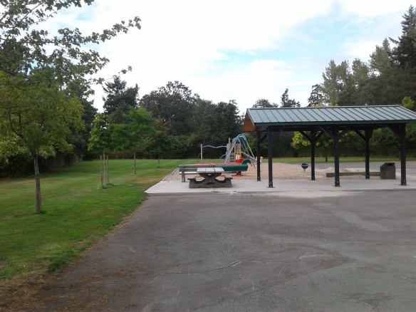
Midland Circle Green Space is located in the seaside community of Oak Bay, part of the Capital Regional District of British Columbia. This green space was formed in earlier nineteen hundreds as part of the terminus of the streetcar to provide access to the Uplands Farm Estates. The asphalt covers the railway bed that formed the initial circle. Several tall Garry oak trees provide shade over the well maintained lawn of the green space.

Geographical Location N48º 26’ 50”  W123º 18’ 6”

Midland Circle Green Space can be accessed from Lansdowne Road. Turn left on the single track Midland Road to reach the green space. Both Cotswold and Ripon roads connect to the road that circles the green space. City buses travel along Midland Road.

Carnarvon Park

Carnarvon Park is in the seaside community of Oak Bay which is part of the Capital Regional District of British Columbia. This park is a small multifaceted jewel in Oak Bay. In the late eighteen hundreds, this area was developed as the Willows horse racing track, presently, the park hosts two baseball diamonds, tennis courts, fenced hockey rink, water park, and other play areas. It is the perfect place for a family outing.  Oak Bay Lawn Bowling Club and facilities are based here. There is a seasonal concession and washroom facilities. The Peter Pan Outdoor Water Park and Playground operates seasonally. A daycare operates out of the main buildings.

Geographical Location N48° 26′ 22″     W123° 19′ 02″

You can get to Carnarvon Park from Foul Bay Road.  Turn east onto Allenby, Townley, or Carnarvon Street.  There is limited off street parking.  Look for trails to Carnarvon Park between Henderson and Newton Streets.  A trail leads to Carrick Boulevard that provides quick access to the Foul Bay Road and Cadboro Bay Road junction. A couple of city buses travel by this park.

Oakdowne Park

Oakdowne Park is in the seaside community of Oak Bay part of the Capital Regional District of British Columbia. This green space lies amongst the houses in the Lansdowne Slope area of Oak Bay.  It is about a five minute walk from the Uplands Golf Course.  The lawn and manicured garden are maintained by the Oak Bay Parks and provide a terrific place to play bocce or simply enjoy the scenery.

Geographical Location N48° 46′ 38″   W123° 18′ 56″

Access to Oakdowne Park is from Lansdowne Road, turn left onto Eastdown Road then right onto Oakdowne Road.  The park is on the left where some street parking is available. A couple city buses travel close to this park.

Nottingham Park

Fabulous architecture and landscaping surround Nottingham Park.  Nottingham Park is located in the seaside community of Oak Bay, a district in the Capital Regional District that forms the greater area of Victoria, British Columbia. Located in the southern side of t the Upland Estates, this park includes a playgym and extensive lawns.  It is shaded by tall Garry Oak trees making it a wonderful place to watch the children play or throw a ball about while enjoying the neighborhood. There are a couple of benches near the play area. The eastern side of the park is bordered by a wooden fence. Loon Bay Park, Uplands Park and Willows Elementary School Green Space are nearby.

Geographical Location N48° 26′ 39″ W123° 18′ 20″

You can get to Nottingham Park from Hillside Avenue that turns into Lansdowne Road.  Cross over Cadboro Bay Road into the Upland Estates and turn right on to Nottingham Street.  Some street parking is available. The city bus travels near this park.

Loon Bay Park

Loon Bay Park is located in the seaside community of Oak Bay, part of the Capital Regional District of British Columbia. This small roadside park is located off Beach Drive and overlooks the marina of the Royal Victoria Yacht Club.  The park has a couple of park benches and beach access points.  A short concrete pathway with a couple of sets of stairs leads to the sand and mud beach. The lawn is adorned with a outdoor piano as well as a small monument.  There are Garry oak and Douglas fir trees that provide shade over the beach and the undergrowth of ocean spray, blackberry and snowberry bushes.  The splendid residential area around the park can easily be included as part of your walk.

Geographical Location W48° 27′ W123° 17′ 44″

You can get to Loon Bay Park from Lansdowne Avenue or Cadboro Bay Road.  Turn onto Beach Avenue and look for the park near the Royal Victoria Yacht Club. There is limited street parking available. A city bus travels past this park  along Beach Drive.

Costain Green

Costain Green is a green space in the District of Oak Bay, a community in the Capital Regional District of British Columbia. This small nature park is at the junction of Beach Drive and Midland Road in the Upland Estates.  This park is unique in that it has preserved as a patch of grass that help to form a Garry Oak meadow and many unique seasonal wildflowers. Deer are seen frequently in this area.

Geographic location N48° 27′ 10″ W123° 18′ 3″

Costain Green can be reached from McKenzie Avenue. Follow Mckenzie Avenue east toward the University of Victoria. The avenue becomes Sinclair Road as it descend into Cadboro Bay Village, with some excellent cafes and shopping. Turn right onto Cadboro Bay Road and follow to the junction with Beach Drive. The first junction along Beach Drive is past this green space. There is limited roadside parking in this neighborhood. A city bus travels past Costain Green.

Cedar Cadboro Green Space

A green space to photograph is at the junction of Cadboro Bay Road and Cedar Hill Cross Road. The large welcome to Oak Bay sign surrounded by flowers and greenery could make a lovely picture. The well-manicured lawn and plants are shaded by the large Garry oak trees in the small green space. This green space is close to Henderson Park, Uplands Golf  Course, the dog walking area of the University of Victoria and Mystic Vale Park.

Geographical location N48° 27′ 14″ W123° 18′ 10″

You can get to Cedar  Cadboro Green Space from McKenzie Avenue. Follow McKenzie Avenue past the University of Victoria. The street changes names and becomes Sinclair Road. Continue down the hill to the junction with Cadboro Bay Road. Turn right onto Cadboro Bay Road and follow along up the hill. This green space is at the junction with Cedar Hill Cross Road. Continue a few meters along Cadboro Bay Road to use the roadside parking along the Uplands Golf Course. City buses provide service along Cadboro Bay Road.

Henderson Park

Henderson Park play

Henderson Park in the seaside district of the Capital Regional District called Oak Bay. The park is located next to the Henderson Recreation Center and Golf Course. The jogging and walking trail winds through and around the golf course.  Runners from the UVic frequent the woodchip trail.  As you walk along  take time to enjoy the forest, the Henderson Gyro Park playground, and the golfers.  Henderson Park has a baseball diamond and several tennis courts.  Toilet facilities are available in the Recreation Center. The woodchip jogging trail has outdoor exercise equipment set along its perimeter. The forest that surrounds the trails and golf course is composed of mostly Garry oak and Douglas fir trees. Snowberry, ocean spray and blackberry bushes make up part of the underground and form the perimeter of the lawns. University of Victoria walking trails are nearby as is Upland School Green Space. This park shares its east border with the Uplands Golf Course.


Geographical Location N48° 27′ 19″ W123° 18″ 44″

You can get to Henderson Park from Cedar Hill Cross Road.  Turn into the parking lot for recreation center.  Parking is also available along the road.  You can access the playground from Arden Street (off of Henderson) where there is limited parking.  The walk takes about 30 minutes. Several buses provide service near Henderson Park.

University of Victoria Trails, Oak Bay


Located outside Ring Road, the wood chip trails of the University of Victoria are frequented by joggers and pet owners.  These jogging trails meander through forested areas and grassy meadows.  Slightly off the beaten jogging trails, the University’s Finnerty Gardens are great place to admire the flowers and shrubs.  You can also brush up on your Latin names for the plants, as the gardeners have name cards near the plants. The campus also is a great place to stroll.

Geographical Location N49º 27’ 39” W123º 18’ 58”

You can get to the University of Victoria from Mackenzie Avenue, Gordon Head Road, or Cedar Hill Cross Road.  Turn on to Finnerty Road, University Drive, Gordon Head Road, or Henderson Road to access Ring Road.  The jogging trails can be found by walking along the Ring Road toward a trail post.  Several trail posts are also visible along Gordon Head or Cedar Hill Cross roads.  Parking is available for a fee around the campus.  Some street parking is available on Cedar Hill Cross Road and Gordon Head Road.  Walks around the University of Victoria campus can easily be extend by strolling into Henderson Park.  Finnerty Gardens are located near the chapel, which is across the parking. lot from the Fine Arts Buildings. Many buses provide service to the university area.