Fisher’s Pond Park


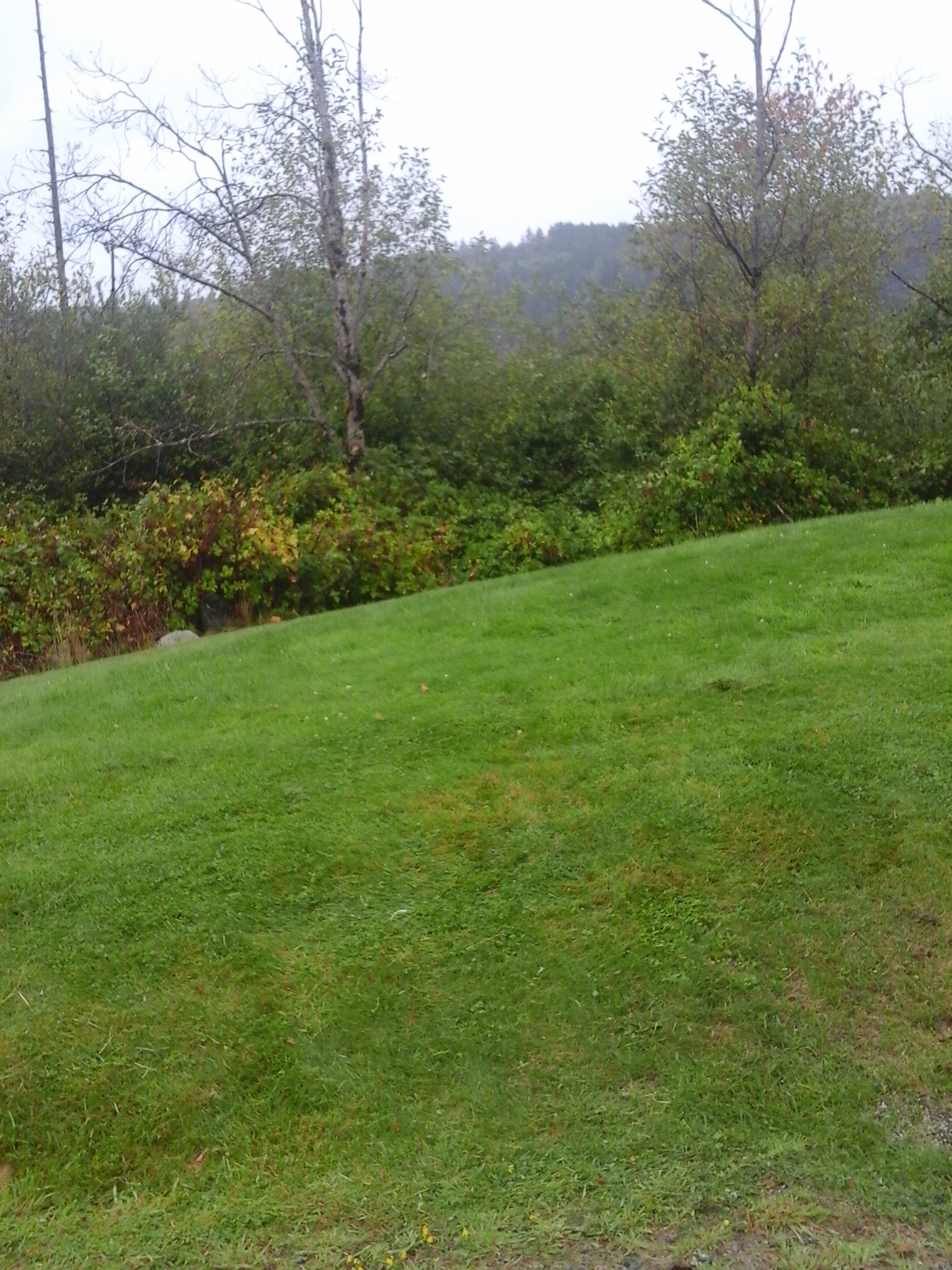
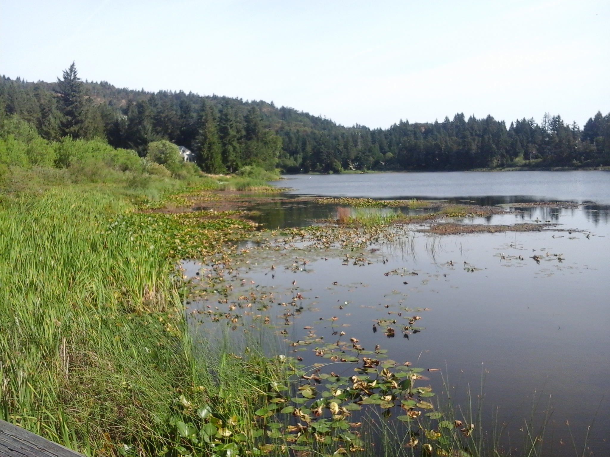
Fisher’s Pond Park is a wetlands area near Glen Lake in Langford, B.C. This park is also referred to as Fisher’s Field. The eleven and half hectare parkland is on the eastern side of Mt Wells Regional Park and is mostly surrounded by private single family homes. There is a proposal to create a parkland that will form a partial wildlife corridor from this wetland to the Sooke Hills. This nature park is a wildlife refuge with a gravel walkway to a boardwalk lookout point. The pathway is about one hundred and eighty meters long. Fisher’s Pond is filled by seasonal rainfall and drains towards Parkdale Creek that runs along the north side of the park. Parkdale Creek connects with Glen Lake and is part of the Colwood Creek watershed. The deciduous forest area is filled with alder, salmonberry, hardhack, red-flowering currant, cedar and Douglas fir trees. Lily pads and marshlands provide habitat for overwintering and breeding waterfowl. Bullfrogs and other animals live in the park amongst the seasonal wildflower such as shooting star, sea blush, skunk cabbage, white fawn lily, common camas, western trillium, western butter cup and fairyslipper or Calypso bulbosa. Irwin Park, City Center Park, Belmont Secondary School Green Space, Galloping Goose Trail-Langford, Langford Lake Park, Leigh Beach Park, Chan Hillside Park, Reginald Park, Young Green Space, Mount Wells Regional Park and Glen Lake Park are nearby.


Geographic location N48° 25’59”  W123°31’41”


Fisher’s Pond Park can be reached from the Trans Canada Highway also called Hwy1. Turn at Millstream exit and continue along south to reach the Veterans Memorial Parkway. Turn onto Sooke Road and continue just past Glen Lake Road. Look for the park entrance between homes 2762 and 2756 Sooke Road.  There is a small gravel parking area near this entrance. There is also easement access to the park from along Glen Lake Road between homes 3150 and 3154. City buses travel along Sooke Road and Glen Lake Road.

Turner’s Bog Park

Turners Bog 3

Turner’s Bog Park is in the Goldstream neighborhood of Langford, B.C. As shallow wetland area that drains toward Langford Lake to connect with Langford Creek, Turner’s Bog has several wetland shrubs, sedges and rushes along its shoreline. The wetlands were formed as a glacial depression called a kettle lake. Langford Creek is part of the Goldstream River watershed. There are few taller trees found near the wetlands too. This park borders on Amy Pond Park which lies to the north and is surrounded by a warehouse for Sysco, a food service distribution company, the West Shore Parkway and Kettle Lake Drive. Amy Pond Park, Lakehurst Park, Gold Stream Provincial Park, Mt Wells Regional Park, Harlequin Park, Goldstream Meadow West Shore Park, Goldstream Meadows Park, Langford Lake Park and several green spaces are nearby.

Geographic location N48° 27’17” W123°32’32”

Turner’s Bog Park can be reached from the Trans Canada Highway also called Hwy1. Turn at the Westshore Parkway and continue along the roadway past the traffic circle. The parkland is on the right just before Kettle Lake Drive. There is limited roadside parking this area. There is a geocashe near this park.

Savory Park

Florence Lake Stachen Trail 7

Savory Park is a nature park in the Florence Lake neighborhood of Langford, B.C. The half hectare parkland borders along the Springboard section of the Florence Lake Strachan Trail, a one and half kilometer long boardwalk and gravel footpath along the south and eastern shore. Savory Park slopes down to the lake from Savory Road and is covered with dense thickets of shoreline vegetation including cattails, alder, willows and ocean spray. Wetlands of Florence Lake form much of the nature area of the park. This park is close to the Trans Canada Highway Pedestrian pathway, a concrete pathway along the roadway that leads southward over the TCH toward Langford Lake.

Geographic location N48° 28’5” W123°30’41”

Savory Park can be reached from the Trans Canada Highway also called Hwy1. Turn at Savory Road/Brock Road Exit and follow the road to curve westward onto McCallum Road. Turn right onto Savory Road and look for the trail marker for the Florence Lake Strachan Trail. This park is to the left of the trail. There is limited roadside parking this area.

Strachan Park

Strachan Park is a nature park in the Florence Lake neighborhood of Langford, B.C. At just over half a hectare, the steep terrain that surrounds the small wetland in this park has helped to maintain its natural integrity. Florence Lake Pier and Viewing Dock, Florence Lake Park North, Florence Lake Strachan Trail Shaw Green Space and Shaw Park are nearby.

Geographic location N48° 27’37” W123°30’36”

Strachan Park can be reached from the Trans Canada Highway also called Hwy1. Turn at Savory Road/Brock Road Exit and follow the road to curve eastward around Florence Lake. Turn right onto Setchfield Avenue then right onto a roadway called Martin Ridge. The park is on the right. There is limited roadside parking this area.

Arngask Park

Arngask Park is in the Florence Lake – Bear Mountain neighborhood of Langford, B.C. This wetland park is surrounded by residential homes, many whom use it as a garden refuse site, and a buffer of trees and shrubs. Douglas fir, cedar and alder trees grow along the shores of the shallow waters. Oceanspray, snow berries and blackberry bushes fill in parts of the six thousand square meters, in an unusual polygonal shape, that form the parkland. A forty meter long gravel trail leads into the park from near the junction of Arngask Avenue and Whisperwind Place. There is a one hundred and fifty meter long concrete pathway into the park from along Echo Valley Drive which connects to Graphite Place. The pathway is fenced with a black metal fence. This park connects to Ironwood Place near the blue water reservoirs. Setchfield Park, Stonegate Park, Ironwood Park and Shaw Park are nearby. As an aside, Arngask is a parish in Scotland in the counties of Kinoss, Perth and Fife.

Geographic location N48° 27’59” W123°30’44”

Arngask Park can be reached from the Trans Canada Highway also called Hwy1. Turn at Millstream Road and turn left onto Bear Mountain Parkway. Continue along BMP to reach Echo Valley Drive. Turn onto Echo Valley Drive and continue along the concrete pathway between 2371 and 2367 Echo Valley Drive. The park can also be access from the corner of Arngask Ave and Whisperwind Place as well as from between 1022 and 1014 Graphite Place and along Ironwood near the water reservoir towers. There is limited roadside parking in this neighborhood.

Goldie Park

This post is updated here.

Mill Hill Regional Park

Mill Hill Thetis Lake Calypso Trail 5 Mill Hill Thetis Lake Calypso Trail 20

Mill Hill stands two hundred and two meters above sea level and lies within the parkland called Mill Hill Regional Park in View Royal, B.C. As a regional park since nineteen eighty, this park is kept by the Capital Regional District which has a large fenced yard with several maintenance buildings within the parkland. The main parking area and trails are in Langford, B.C., where the partially paved trail (an old fire road), called Auburn Trail, leads to the top of the hill. There are toilets and picnic tables near this parking area. The Auburn Trail skirts the south and western slopes. The east side of the park is within View Royal and is bordered by Edwards Park and several private properties. This northeastern slope of Mill Hill is accessed using Calypso Trail. The Calypso Trail, about two kilometer trail long, is a rough pathway along Hwy1 and becomes a woodland trail as it climbs to the summit to connect with Auburn Trail. Douglas fir, arbutus, western red cedar and garry oak trees are seen along the trail. Near the summit are several shallow wetlands, moss covered rocks and small meadow areas where big-leaf maple, red alder are seen. Salal, Oregon grape and other small shrubs are seen in the park. Near the junction of the two trails are the concrete foundation blocks of the nineteen fifty eight fire lookout tower. A rock cairn with brass direction location lines on its surface lies near the concrete blocks. Calypso Trail then continues to the parking lot down a steep section on the eastern side of the hill. The park has several ecosystems along its slopes although most have been modified over the past hundred years to meet the needs of the area. Along the lower northeastern section of the Calypso Trail, beside Hwy1, pick some Himalayan blackberries in the late summer. A stroll along the forested section of this trail, in the springtime, reveals the small wildflowers like camas, white fawn lilies and fairyslippers (Calypso bulbosa), the namesake of this trail. A visit to this seventy-one hectare parkland is worthwhile and easily explored as a walk in your backyard.

Geographical location N48° 27’ 10” W123° 28’ 55” parking lot

Mill Hill Regional Park can be accessed from the Trans Canada Highway, Hwy1, and is located at 490 Atkins Road. Exit from Hwy1 to reach the Island Highway and turn right onto Six Mile Road. Continue along Six Mile Road just after the Galloping Goose Trail overpass, turn left onto Atkins Road. The park entrance on the right is on the right and is along a curve of the road in this quiet urban neighborhood. A second road to the right provides access to the maintenance buildings that are within the chain-link fenced area of the park. A large paved parking area is near the park buildings while a much larger gravel area is within the fenced area. City buses travel along Atkins Road.

There are several documents on the ecosystems within Mill Hill Regional Park.

Thetis Lake Park –Prior Lake

Prior Lake dock 4Prior Lake is an oval shaped lake about one hectare in size. It is in the Thetis Lake Regional Park. A small creek connects Thetis Lake to Prior Lake which is home to cutthroat and rainbow trout, minnows, sunfish and many insects. While relatively shallow it is a good place for a swim after hiking the trails of Thetis Lake Park. The McKenzie Creek Trail passes along a ridge on the north shore of the lake and continues toward McKenzie Lake and Stewart Mountain or Seaborn Trail, which connects to Upper Thetis Lake Trail. There is a wharf and dock on Prior Lake that is designated for clothing optional swimming on the south side of the lake; dogs are not permitted during summer months. Since the nineteen nineties this area of the lake was taken over by nude bathers although mostly during the summer months. The lake is a short walk from Highland Road in View Royal, B.C. Thetis Lake Panhandle Trail and McKenzie Creek Trail, Highland Road Green Space, Westoby Road Green Space are nearby.


Geographic location N48° 27’47 W123°28’3”


Thetis Lake Park – Prior Lake can be reached from the Trans Canada Highway or Hwy1. Turn off Hwy1 using exit #10 to reach Burnside Road West. At the four way stop turn left onto Watkiss Way. Continue along Watkiss Way as the road curves right to become Highland Road. Once past the residential area the road enters the parkland and becomes narrower. The trail is found in a small pull-out that is just before the bridge over McKenzie Creek. There is limited roadside parking along Highland Road.


For a map of the hiking trails in Thetis Lake Regional Park, see the CRD Parks brochure.

Kanishay Road Park, North Saanich

This lovely cedar, Douglas-fir and cottonwood forest  has multi-use trails that are frequently used by equestrians as well as hikers, dog walkers and cyclists. The one hundred and fifty meter trail connects West Saanich Road, Woodcreek Drive and Lands End Road. Within the two hectares of parkland there are wetlands and second growth forests to explore. The park borders on an impressive horse training estate.

Geographic coordinates  N48° 41′ 30″ W123° 27′ 37″ from end of Kanishay Road

You can get to Kanishay Road Park from Pat Bay Highway.  Before you reach ferry terminal follow the signs that lead to Lands End Road.  Cross over the overpass and continue on Lands End to  turn left onto West Sannich Road.  Take the next left onto Kanishay Road to find parking and look for the trail near the end of the road.