Oak Bay Native Plant Garden


Oak Bay Native Plant Garden is in the seaside community of Oak Bay, one of thirteen areas of the Capital Regional District of British Columbia. This landscaped quarter of an hectare contains a unique collection of locally grown plants in a nurtured setting.  A wood chip trail leads around the park. Stroll past Garry oak, pacific madrone, elderberry, dogwood and black hawthorn trees.   There is also a small pond complete with a trickling fountain with evergreen huckleberry, red flowering current, Oregon grape and mock orange shrubs. The undercover is beautiful with blooms from springtime flowering plants like camas, trillium and violets. Several ferns such as maiden hair, sword, licorice, oak and bracken might also be seen.   Benches are available in the parkland; the property was donated by Ada Beaven in memorial of her husband Hugo. The rose garden in Oak Bay has the same beneficiaries. The Beavens were both from influential and remarkable families during the early nine hundreds in the Oak Bay.

Geographic Location N48º 25’ 13”  W123º 18’ 1”

The Oak Bay Native Plant Garden can be reached from the Trans-Canada Highway. Continue along the Hwy 1 into Victoria as it becomes Douglas Street. Turn off Douglas onto Hillside Avenue to head east.  Stay on Hillside Avenue as it becomes Lansdowne Road. Continue along Lansdowne Road to reach Beach Drive. Continue along Beach Drive to reach Margate Street. The garden is across the road from the Oak Bay Beach Hotel.  To extend this into a walk, continue along beach Drive toward the Victoria Golf Course or to Turkey Head Walkway.  This park can be access by bus.

Devonian Regional Park

Devonian Regional Park is in the District of Metchosin, a coastal community in the Capital Regional District of British Columbia. This ocean front park was acquired from the Devonian Foundation Alberta, formed by the lawyer, oil man and philanthropic Eric Harvie, and the provincial government in 1980. It is one hundred and thirty five square kilometers of forest area with Sherwood Pond providing a wetland oasis amongst the Douglas fir and Garry oak woodlands. The kinglet, great horned owl and pileated woodpecker might be sighted in the park. This wildlife sanctuary is tucked into the gently rolling landscape between Metchosin farms. A bridle trail lies along the southern perimeter of the park. There are parking and picnic areas. Sherwood Creek flows into the pond and acts as guide for the well-trodden footpaths. The Douglas fir and arbutus trees in the park can be explored by strolling along the gravel trails. The main trail leads through the forest about twelve hundred meters to reach the cobble and pebble Taylor Beach that lies on Parry Bay. The beach overlooks the Strait of Juan de Fuca and the Olympic Mountains. Witty’s Lagoon can be reached by strolling along the water eastward along Taylor Beach. The distance is about six kilometer round trip. Taylor Green Space is about five hundred meters eastward along the waters edge. At the park entrance is a small parking area with toilets. Benches can be found in this park too.

Geographical location N48º 21’ 57” W123º 32’ 32”

Devonian Regional Park can be reached from Highway 1 when you exit at the Millstream /Veteran Memorial Parkway exit. Head south along the Veteran Memorial Parkway to reach Latoria Road. Turn left onto Latoria Road and continue along to reach Metchosin Road. Turn right onto Metchosin Road and watch for the signs to Witty’s Lagoon Regional Park. Continue along Metchosin Road past the junction with Happy Valley Road. The name changes to William Head Road. Continue along until you see the signpost for the park on the left. There is small parking area. City buses travel along Metchosin Road.

Braeburn Park

Braeburn Park
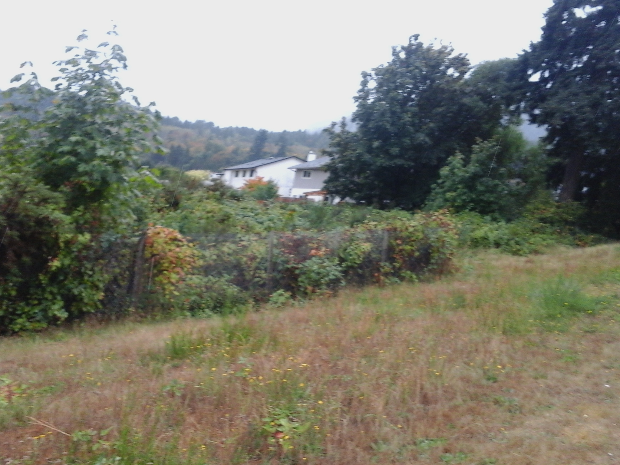
Braeburn Park is in the Happy Valley neighborhood of Langford, BC. This nature park has a circular walking trail and a small pond that is feed by Colls Creek. The forest is a mixed wetland with cedar and big leaf maple as well as salal, ferns as well as ocean spray and hardhack shrubs. The gravel trail of that circles the pond is about eight hundred meters long and has a couple of foot bridges across the creek. Colls Creek continues flowing southwest to connect with Bilston Creek and Witty’s Lagoon which drains into the Strait of Juan de Fuca. The gravel walking trail has branches that connect to Thrush Park and Gala Court, Happy Valley Road, and Braeburn Avenue. Turnstone Park, Willing Park, Luxton Park, Kinglet Park and the Galloping Goose Trail – Langford are nearby,


Geographic location N48° 25’16”  W123°31’58”


Braeburn Park can be reached from the Trans Canada Highway also called Hwy1. Turn at Millstream exit and continue along south to reach the Veterans Memorial Parkway. Turn onto Sooke Road and continue along to reach Happy Valley Road. The park is between Gala Court and Braeburn Avenue on the left side of Happy Valley Road. There is some parking along Baeburn Avenue. City buses travel along Happy Valley Road.


City Center Park – Langford


City Center Park is in the Langford and Glen Lake areas of Langford, B.C. The park has seasonal spray-park as well as several active entertainment areas like mini golf, bowling, play zone, ice rink and arena areas. While not a nature park there are a few palm trees near the outdoor spray-park as well as some outdoor sculptures of ice skaters “Grandsons on Ice” sculpted by Armando Barbon. City Center Park includes the Goudy Park, Westhills Stadium and Arena as well as a small pond with a brick pathway. This pathway has outdoor gym that is available year around. Design a workout that includes the rowing apparatus, Tai Chi wheels, pullup bars, dip bars, multibars, angled benches and more. Toilets are available during business hours and special events at the park. This park is close to Leigh Beach Park, Langford Lake Park, Glen Lake Park, Ed Nixon Trail, Le Quesne Park, Belmont Secondary School Green Space and several other green spaces.


Geographic location N48° 26’35”  W123°31’31”


City Center Park can be reached from the Trans Canada Highway also called Hwy1. Turn at Leigh Road exit and continue along to turn left onto Goldstream Avenue. Follow Goldstream to Jacklin Road and turn onto Jacklin Road to reach Langford Parkway. Continue along Langford Parkway and look for the large signs on the left for the City Center Park. Two turf sports fields lie to the immediate west of this entertainment area. There are ample parking areas near this park. City buses travel along Langford Parkway.

Peatt Fire Hall Green Space

Peatt Rd Fire HallThe Peatt Fire Hall Green Space is in the downtown area of Langford, B.C. This green space hosts the large welcome sign to greet travelers arriving into Langford using Veteran’s Memorial Parkway. There is a small cascading waterfall and pond behind the sign. Located next to Fire Station One there is a life size statue of fireman raising a flag. The flag poles are near of the entrance to the fire hall. Commissioned in 2003 to Derek Rowe, the statue is one of six outdoor art works found in the downtown area of Langford. Sunderland Peatt Green Space, Arnote Park, Sunderland Deville Green Space, Porcher Park and Peatt Green Space are nearby.


Geographic location N48° 26’59” W123° 29’ 52”


Peatt Fire Hall Green Space can be reached from the Trans Canada Highway also called Hwy1. Turn at Millstream Road/Veterans Memorial Parkway and head south toward Goldstream Avenue. Turn left onto Peatt Road then right onto Dinan Place where there is a small a parking area. City buses travel along Veteran’s Memorial Parkway.

Amy Pond Park

Amy Pond Park grass

Amy Pond Park is in the Goldstream neighborhood of Langford, B.C. The shallow pond, fenced with a tall chain link fence, drains toward Turner’s Bog and is part of the Langford Lake wetlands. There is a one hundred meter gravel foot path that connects into the quiet residential area from Amy Road. Himalayan blackberries, snowberries and a few other shrubs grow in this parkland. The park borders along Turner’s Bog Park which lies to the south and Lakehurst Park which lies to the north and west. Gold Stream Provincial Park, Mt Wells Regional Park, Harlequin Park, Goldstream Meadows Park, Langford Lake Park and several green spaces are nearby.

Geographic location N48° 27’30” W123°32’42”

Amy Pond Park Turner’s Bog can be reached from the Trans Canada Highway also called Hwy1. Turn at the West Shore Parkway and make a right onto Amy Road to pass the gas station. Continue along Amy Road which merges with Sooke Lake Road. The trail into the park is at the pedestrian crossing over Amy Road near the large Sysco warehouse and fenced pond. There is limited roadside parking this area.

Hansen Park

This post is updated here.

Hansen Park

Dominion Brook Park, North Saanich

Dominion Brook Park, North SaanichThis park is a gem. Four and a half hectares of parkland developed, in nineteen twelve on the lower eastern slopes of Mount Newton, using imported and native plants. Curiously, hundreds of plants collected worldwide over the last one hundred years are for us to explore, right in our backyards. Originally a public display garden associated with the Dominion Experimental Farms, this park was granted the name through connection with the Dominion Parks Branch, now Parks Canada. In its early years it had several famous visitors and continues to welcome many more, maybe that is you. This parkland was designed and landscaped to take advantage of the rolling and rocky terrain as well as the creek that flows through a series of small ponds. There are rock walls and several rock and concrete stairs that lead to the flowing waters of Dominion Brook. The large ornamental garden with exhibition arboretum is maintained by the Friends of Dominion Brook Park, a for-purpose association working to maintain the plants and parkland. As it is located next to the Center of Plant Health, the old Dominion Experimental Farm, a federal funded quarantine center for Canada, there is a chain link fence lining the southern and eastern sides of the park. There is also a chain link fence barrier around much the ravine for the creek and ponds. Enjoy the view of the ocean waters of Bazan Bay and the islands in the Salish Sea including James, Sidney, Forest and Gooch islands. On clear days the San Juan Islands of the United States and the snowy peak of Mount Baker make a beautiful backdrop for photographs in this park. There are plenty of benches, viewpoints and picnic sites to enjoy on your exploration. This park can be accessed from pathways off Marshall Road yet the best access is off of East Saanich Road. The old experimental farm park is popular and is frequented by hikers, dog walkers, and gardeners.

Geographic coordinates N48° 37′ 20″ W123° 25′ 4″

Dominion Brook Park can be reached from Pat Bay Highway. Leave the highway at Exit 26, the McTavish Interchange, a unique and confusing series of roundabouts that make a multi-circle roadway overpass. Take the third exit onto McTavish Road then take the second exit to stay on McTavish Road. Follow McTavish Road to the East Saanich Road intersection. Turn left onto East Saanich Road and continue past the Panorama Recreation Center on the right. Dominion Brook Park is indicated by the large sign to the left. There is roadside parking along East Saanich Road in front of the park along the split-cedar rail fence. Alternatively, catch a city bus to this park from along East Saanich Road.

Gardner’s Pond, North Saanich

Gardner's Pond 2

Originally created for collection of peat moss and farming of blueberries in the nineteen fifties by the Gardner family, this private pond is now home to a diverse number of migratory and resident birds as well as other wildlife. The ponds forms part of the watershed of Chalet Creek which drains into the waters of Deep Cove. The nearly four hundred meter  trail provides views of the shallow murky waters from the western side of the pond. Alder and cottonwood trees grow at the pond’s edge . This trail can be wet as it skirts between pond and private residences. Gardner Pond is a peaceful area to stroll or  watch the birds. There is a bench near the water’s edge too.

Geographic coordinates to Mulberry Place N48° 41′ W123° 26′ 51″

You can get here from Pat Bay Highway.  Exit the highway onto McDonald Park-Wain Road and use the overpass to circle around and over to reach Wain Road. Turn left onto Wain Road and travel along until Tatlow Road, which exits to the right. Take the first left off of Tatlow Road onto Alder Road. As you go up the hill look for the hiking trail maker on the right. There is limited road side parking along Alder Road. Continue to the junction with Maple Road where you will see another hiking marker; this trail leads to  the junctions with either Clayton, Tatlow or Wain roads. To reach Gardner Pond continue on Maple Road to turn right onto Mulberry Place. There is limited parking beside the trailhead at the end of the cul-de-sac.