Thetis Cove Green Space

Thetis Cove Green Space 2

The Town of View Royal, BC, has some unique waterfront views of Fisgard Lighthouse, forested areas, watery reefs set with the backdrop of the Olympic Mountains of Washington State. This is one of those amazing places. Thetis Cove Green Space is located on a ridge along View Royal Avenue in View Royal, B.C. The view is eastward across the waters of Thetis Cove and Plumper Bay, which are part of Esquimalt Harbour, toward Richards Island and Thetis Cove beach. There is a rough pathway to the beach. Portage Park, the CRD Rail Trail and Beaumont Beach are nearby.

Geographical location N48° 27’ 2” W123° 26’ 7”

Thetis Cove Green Space can be reached from the Trans Canada Highway also called Hwy 1. Turn south onto Admirals Road at the McKenzie Avenue-Admirals Road junction. Continue along Admirals Road across the bridge over the Gorge Waterway. Turn right onto the Island Highway and pass under the railway bridge and take the next left onto View Royal Avenue. The Four-Mile Pub and Restaurant is located at this intersection. The green space is located to the left as the avenue curves to the right. There is limited parking near the green space. City buses travel along the Island Highway and View Royal Avenue.

Portage Park

Portage Park Richards Island Thetis Cove

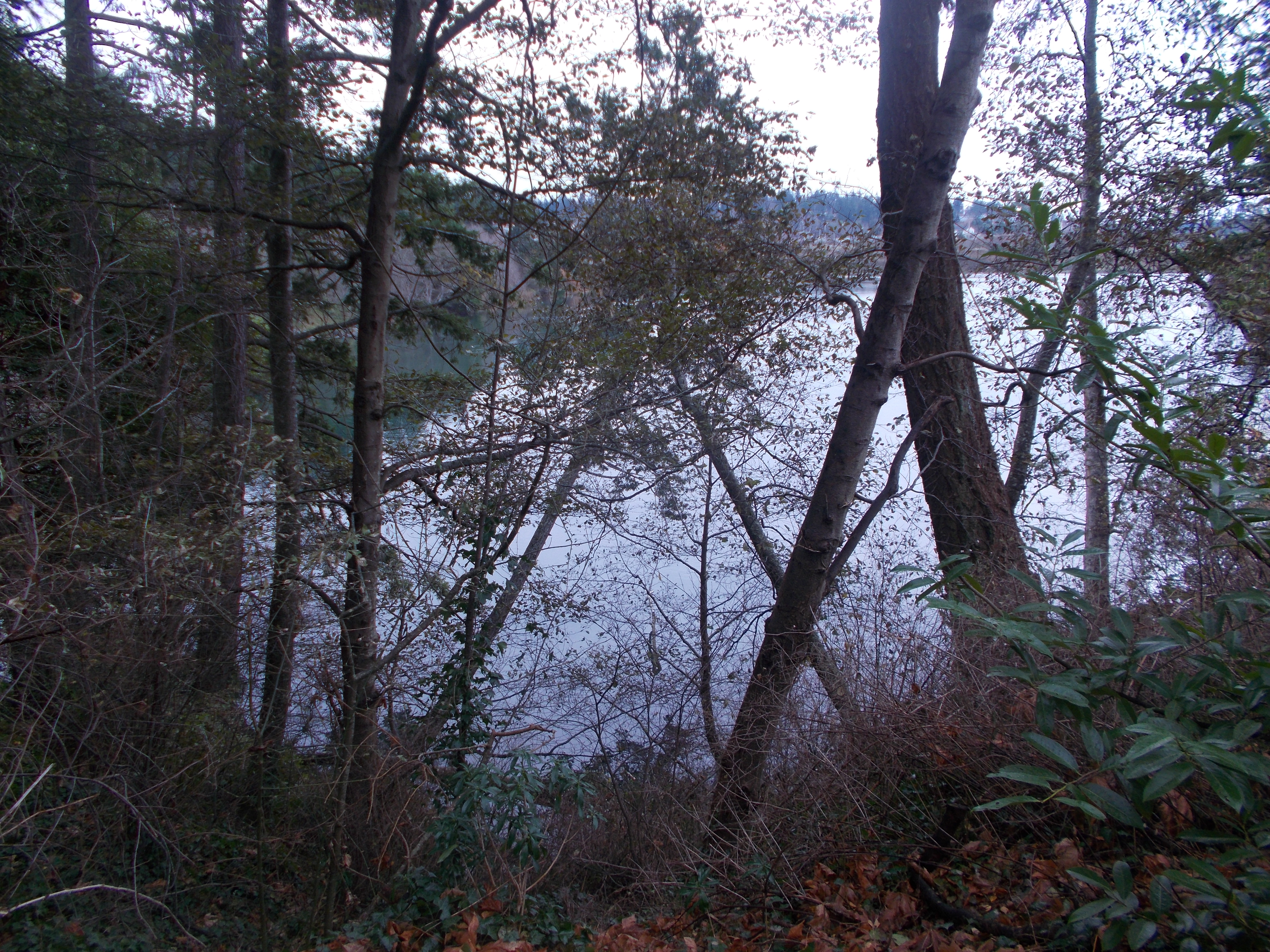
Enjoy a stroll through an urban Douglas fir and Garry oak forest to see the inspiring views of Richards Island, Fisgard Lighthouse and the distant Olympic Mountains in Washington State in Portage Regional Park, View Royal, B.C. This park lies along the north shore of Esquimalt Harbour and is along the portage route between the harbour and the Gorge Waterway. The portage route encompasses several roadways although the distance is about six hundred meters from shore to shore. This six point two hectare community park is bordered by residential homes and businesses on its east and west sides while the northern perimeter is formed by the Island Highway. Thetis Cove beach and Esquimalt Harbour are on the south side.


The CRD Rail Trail lies beside the VIA rail tracks and divides the park into an eastern and western portion. The western side of park is larger and has the majority of the trails as well as the playground and beach. The pedestrian pathways form about two kilometers of trails through the Douglas fir, Garry oak and woodland shrub forest. Enjoy the thimbleberry, blackberry and snowberry bushes as well as salal, ferns and mosses. Many bird species use this parkland as well including great blue heron, turkey vultures, common ravens, northwest crows and northern flickers. This makes it a popular place for local birders as well as dog walkers, hikers and those who enjoy a stroll in the urban forest. Richards Island is part of the parkland and is accessible by private vessels, like kayak, paddleboards or canoes. There are shallow rocky reefs around this island that has small Garry oak and Douglas fir trees. Thetis Cove has an average depth of about a meter with the deepest water along the western side of the cove near Dyke Point.


The partial paved and gravel trail to the beach starts near the town hall building and is about one hundred and seventy meters. The washrooms are also near here. There is a flight of about twelve steps down to the dirt and wood chip trail which branches south to the Thetis Cove beach and east toward the Rail Trail. The beach trail crosses over an ephemeral stream during its one hundred meter length. Thetis Cove beach is a mud flat beach area and is best accessed at higher tides. The eastern woodland trail also has some with steep stairs that makes wheelchair access difficult although the Rail Trail can be used with relative ease. A fire hydrant in the forest marks the junction of the trail which branches to the beach and to the Island Highway. There are benches and picnic tables in several locations in the parkland.   A shell midden was revealed by a seasonal storm several years ago. A sign marks this location where the organic debris may depict over five thousand years of periodic usage by humans. Thetis Cove beach, at low tide, is a mud flat with a few small areas of fine sand. A secondary access directly to the mud beach is from Thetis Cove Green Space using a steep fifty meter long trail. This green space is found along View Royal Road between homes 101 and 95.


Geographical location N48° 27’ 06” W123° 26’ 1”


Portage Regional Park can be reached from the Trans Canada Highway also called Hwy 1. Turn south onto Admirals Road at the McKenzie Avenue-Admirals Road junction. Continue along Admirals Road across the bridge over the Gorge Waterway. Turn right onto the Island Highway and pass under the railway bridge and take the next left onto View Royal Avenue. The Four-Mile Pub and Restaurant is located at this intersection. The main entrance and parking area for this park is on the west near the View Royal Town Office on View Royal Avenue. Additional routes in the park are from along the Island Highway and from the CRD Rail Trail. The eastern side is accessible from Glentana Street near Ethos Place, Falstaff Place, Aldersmith Place and Hallowell Road. City buses travel along the Island Highway and View Royal Avenue.


Several documents have been produced for the Town of View Royal about this park and provide a worthwhile read.

Demos Place Green Space

Demos Place Green Space has gravel trail that connects to the east side of Portage Park in a quiet neighborhood of View Royal, B.C. This side of Portage Park is separated from the westside by the E&N Rail Trail and railway. There is a concrete tunnel under, as well as a pathway over, the railway. The park area is about a hectare of Garry oak, big leaf maple and Douglas fir forest. It is a wonderful place to stroll and place to explore in your backyard. There are rough trails throughout the forest and the pathway connects to Glentana Road and Aldersmith Place Green Spaces. This section of the park is locally known as Glentana Park and is surrounded by residential homes both private and townhomes. It is short walk to Shoreline Community Middle School Green Space, Craigflower Manor Gardens and Shoreline Drive Green Space.


Geographical location N48° 27’ 05” W123° 25’ 50”


Demos Place Green Space can be reached from the Trans Canada Highway (Hwy 1). Turn south onto Admirals Road (McKenzie Avenue is north from this intersection). Stay on Admirals Road and cross over the Craigflower Bridge, at which point the road names changes to Craigflower Road. Continue past the intersection of Craigflower Road to stay on Admirals Road. Take the next right onto Glentana Road. Demos Place is at the round-about near the end of Glentana Road. The trail is between homes 25 and 28 Demos Place. There is limited parking along Glentana Road. City buses travel along Admirals Road and the Island Highway.

Glentana Road Green Space


Glentana Road Green Space has a gravel trail that connects to the east side of Portage Park in a quiet neighborhood of View Royal, B.C. Portage Park is divided by the E&N Rail Trail and railway. There is a concrete tunnel under, as well as pathway over, the railway. The park area is about a hectare of Garry oak, big leaf maple and Douglas fir forest. It is a wonderful place to stroll and place to explore in your backyard. There are several desire trails throughout the forest and a ten step wooded staircase about sixty meters from Glentana Road. The pathway connects to Demos Place and Aldersmith Place Green Spaces. This section of the park is locally known as Glentana Park and is surrounded by residential homes both private and townhomes. It is short walk to Shoreline Community Middle School Green Space, Craigflower Manor Gardens and Shoreline Drive Green Space.


Geographical location N48° 27’ 4” W123° 25’ 45”


Glentana Road Green Space can be reached from the Trans Canada Highway (Hwy 1). Turn south onto Admirals Road (McKenzie Avenue is north from this intersection). Stay on Admirals Road and cross over the Craigflower Bridge, at which point the road name changes to Craigflower Road. Continue past the intersection of Craigflower Road to stay on Admirals Road. Take the next right onto Glentana Road and look for the trail marker on the left. The trail is near Ethos Place. There is limited parking along Glentana Road. City buses travel along Admirals Road.


Note: Easement right of way from Glentana Road between homes 1500 and 108 is gated to limit access.

Shoreline Middle School Green Space

Shoreline Middle School play area

The school is part of the Victoria School District number sixty-one and as such the school grounds are used for students during school hours. The area is landscaped with a few arbutus and Garry oak trees as well as a large grass covered field. This is the sports field that is used for soccer, baseball and rugby as well as track and field. There is a trail along the ridge of grounds that parallels the sidewalk along the Island Highway. The road forms the south border of this green space. An excellent playground is along the ridge near the fenced basketball court. The playground is on a wood chip based and a linear setup that is great for climbing and balancing. The view of Portage Inlet from the playground makes this a favorite place. The green space is near the portage route or the shortest walking access to Esquimalt Harbour via Portage Park. This portage route was used haul boats and supplies from the Inlet to the Harbour. Craigflower House and Shoreline Drive Green Space are close by. Portage Park and the E&N Rail Trail are to the west.

View Royal Elementary School Green Space

Located near Craigflower Creek and Portage Inlet, View Royal Elementary School Green Space is a terrific area to enjoy outside of school hours. The school grounds are just under three hectares. The area at the front of this fifty year old building is a tri-level area. The lower area is a paved parking space for teachers, staff and parents. A dozen concrete stairs lead up to the basketball court, a ball toss basket and circles painted on the asphalt for fox and hound outdoor games. There is a chain-link fence surrounding this raised area. The concrete retaining wall around the basketball court depicts colorful images of children at play. The upper level has a playground with a wood chip base and is bordered by a grass covered area. This playground has various climbing apparatus that connect to a platform with a slide. A cedar hedge fence forms a partial barrier along Helmcken Road while the chain-link fence is decorated with fish in a colorful display. A map of North America is painted on the asphalt near this playground. A small sloped grass covered area provides a natural play area along Rudyard Road and Glenairlie Drive. Several spruce and big leaf maple trees as well as several shrubs grow in this area. Near the entrance to the school are six raised garden beds near the school.

Two other playground areas are shared with the preschool and out-of-school care facilities that are part of the school campus. A playground area, around the back of the school building, has swings, metal monkey bars and climbing apparatus. There are two squares painted into quarters and a painted spiral for hopscotch on the asphalt near this playground. A large grass covered sports field lies along the E&N Railway track and rail trail. This north side of the school grounds is framed by a row of deciduous trees. A footpath connects the green space to both Rudyard Road, via these series of multi-step concrete staircases, and to Glenairlie Drive along a paved sloped pathway that is bordered by a black berry bushes and a row of trees. The green space and building that forms the elementary school grounds are part of the school district of Victoria number sixty one. Helmcken Park, Glenairlie Park, Portage Park and View Royal Municipal Park are nearby.

Geographical location N48° 27’ 27” W123° 26’ 13”


View Royal Elementary School Green Space can be reached from the Trans Canada Highway (Hwy 1). Exit onto Helmcken Road and turn south. Continue past the first traffic circle to the second one, near Craigflower Creek, and exit into the school parking lot. City buses travel along Helmcken Road.

E &N Rail Trail – View Royal

E&N Rail Trail Portage Park E&N Rail Trail Portage Inlet

This three kilometer regional trail parallels the E&N railway track from Halloway Road to Atkins Avenue in View Royal, B.C. While there is typically a footpath on or along railbeds, the E&N Rail Trail – View Royal is being developed into a paved multi-user trail that lies beside the functional railway track. The rail trail hooks up with the Galloping Goose Trail and Trans Canada Trail at Atkins Avenue.


From Halloway Road, the Rail Trail passes through the Douglas fir and Garry oak forest of Portage Park. There are several footpaths into the park including one that leads to a tunnel that passes under the railway. The pedestrian bridge over the Island Highway is at about seven hundred meters from Halloway Road. From the bridge there are views of the waters of Portage Inlet and the hills to the north. The trail also ties in with the cyclist route beside the Island Highway with a paved curved ramp. The Rail Trail continues to bend along the waters of Portage Inlet and is bordered by private properties on the south side. The trail curves to head westward along the estuary and shore of Craigflower Creek. There are red alder and willow trees that form the riparian area which is the habitat for many local and migratory birds. The grass coverd slope of Glenairlie Park can be seen to the south. As the rail trail reaches the bridge over Helmcken Road, View Royal Elementary School Green Space with sports fields and playground areas can be seen. Once past the bridge, the landscaped and grass covered area of View Royal Park encourage an excursion from the trail in this lovely residential area with royal views. The Rail Trail continues through residential complexes and single family homes to reach Fort Victoria. Palmer Station, an original VIA Rail stop, divides the pleasant camping and recreation vehicle grounds of the Fort Victoria RV Park. Soon the forested area of Kislingbury Road Green Space is seen to the left while the Adams Place Green Space lies further along to the right just after the storage facility with many cargo boxes. The trail eventually connects to the Atkins Avenue junction with the Galloping Goose Trail.


Note as of December 2014 this trail is under construction and sections are incomplete.


Geographical location N48° 27’ 47” W123° 25’ 50” at Halloway Road


The Rail Trail – View Royal can be reached from the Trans Canada Highway (Hwy 1). Since the rail trail connects with the Galloping Goose Trail-View Royal the route can be accessed from Atkins Avenue where there is a small parking area. To reach the Halloway Road section of the Rail Trail exit Hwy1 onto Admirals Road and continue passed Craigflower Bridge and Road to turn right onto Halloway Road. There is limited roadside parking near the trail head at the end of Halloway Road. City buses travel near this trail at many road crossings.