Mill Stream South Park

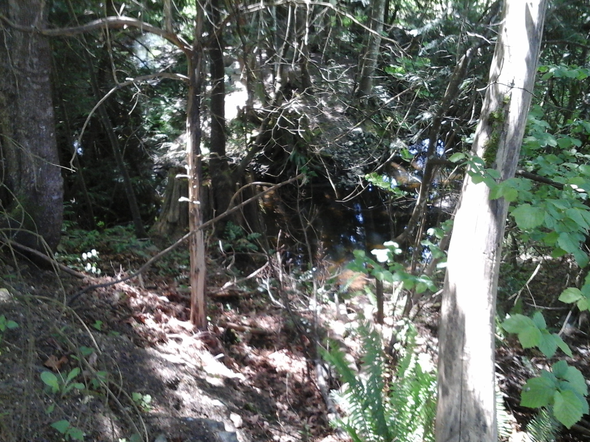
Mill Stream South Park is in the Mill Hill neighborhood of Langford, B.C. Douglas fir trees, western red cedar, sword ferns, deer ferns, mosses and lichens form the second growth forest found in this nature park. The park is part of the riparian area of Mill Stream in Langford, B.C. Mill Stream, or Millstream Creek as it is often called, is the main waterway in a watershed that starts in the Gowlland Tod range of the Highlands and includes seven lakes and numerous ponds. There is about five kilometers of Mill Stream that lie within the City of Langford. Mill Hill Regional Park and Leggett Park are across Atkins Road. Savory Elementary School Green Space, Crystalview Park, Mill Pond Park and Crystalview Elementary School Green Space are near by

Geographic location N48° 27’2” W123° 28’ 54”

Leggett Park can be reached from the Trans Canada Highway also called Hwy1. Turn at Veteran Memorial Parkway/Millstream Road and turn south. Continue along the parkway to turn left onto Hoffman Avenue. Follow Hoffman Avenue to Winster Road and onto Atkin Road. The park is on the right near the driveway into Mill Hill Regional Park. This is limited parking on Atkin Road and limited access to this parkland.

Jeanine Place Green Space

Jeanine Place Green Space is a nature area in the Mill Hill neighborhood of Langford, B.C. This green space is a linear half an hectare area that protects the riparian zone of Mill Stream. There is limited access along its steep forested slopes. Cedarvale Park is immediately upstream and has several picnic tables along the footpath through it. Jeanine Park and Selwyn Cedarvale Green Space are nearby.

Geographic location N48° 27’26” W123° 29’ 12”

Jeanine Place Green Space can be reached from the Trans Canada Highway also called Hwy1. Turn at Veteran Memorial Parkway/Millstream Road and turn south. Take the first left onto Strandlund Avenue and continue to the left to stay on Strandlund Avenue. Follow the roadway then turn right onto Selwyn Road. Take the first left onto Mill Hill Road and then another left after crossing over the small bridge over Mill Stream. The green space extends along the right side of Jeanine Place where there is roadside parking.

Cedarvale Park

Cedarvale Park is in the Mill Hill neighborhood of Langford, B.C. A section of Mill Stream lies within this parkland which also borders on the Hwy1 and the Selwyn Cedarvale Green Space. Mill Stream, or Millstream Creek as it is often called, is the main waterway in a watershed that starts in the Gowlland Tod Range of the Highlands and includes seven lakes and numerous ponds. There is about five kilometers of Mill Stream that lie within the City of Langford. A large sign for Cedarvale Park lies near the eastern junction of Jeanie Place and Mill Hill Road and is bordered by cedar hedge trees. The gravel trail for the park is on the other side of the hedge. Along the trail there are several large western red cedar trees and a large big leaf maple tree. The footpath is frequented by walkers, hikers and dog walkers who enjoy walking along bank of Mill Stream. A trail meanders along the creek with several picnic tables with views of the waterway. The trail connects to the trail that leads toward Jeanie Park along the Selwyn Cedarvale Green Space.

Geographic location N48° 27’26” W123° 29’ 12”

Cedarvale Park can be reached from the Trans Canada Highway also called Hwy1. Turn at Veteran Memorial Parkway/Millstream Road and turn south. Take the first left onto Strandlund Avenue and continue to the left to stay on Strandlund Avenue. Follow the roadway then turn right onto Selwyn Road. Take the first left onto Mill Hill Road and then another left after crossing over the small Mill Stream bridge. The sign for the park is on the left which is also where roadside parking, along Jeannie Drive, can be found.

Selwyn Cedarvale Green Space

Selwyn Cedarvale Green Space is in the Mill Hill neighborhood of Langford, B.C. This rough seventy meter long footpath from Selwyn Road connects to the trails in Cedar Vale Park. The gravel pathway is border by patches of Himalayan blackberries that grow beside the fences. The trail crosses over the tunnel that protects Mill Stream as it passes under the Trans Canada Highway. Eventually the pathway branches as it reaches Cedarvale Park. There are some tall western red cedar trees that grow along the banks of Mill Stream in Cedarvale Park. The route that continues along toward Jeannie Park is shaded by deciduous trees like cottonwood and big leaf maples as well as a few Garry oak trees. Cedarvale Park, Jeannie Park, Mill Park, Olympia Glacier Green Space and Welwyin Fall Park are nearby.

Geographic location N48° 27’26” W123° 29’ 12”

Selwyn Cedarvale Green Space can be reached from the Trans Canada Highway also called Hwy1. Turn at Veteran Memorial Parkway/Millstream Road and turn south to head toward downtown Langford. Take the first left onto Strandlund Avenue and continue to the left to stay on Strandlund Avenue. At the junction with Selwyn Road turn left. Look for the footpath next to the concrete wood-like and chain link fences that lies near the Trans Canada Highway. There is limited roadside parking this area which is beside the Kingdom Hall.

Citation Green Space

Citation GS 1

Citation Green Space is along the gated paved section of Citation Road in Langford, B.C. The seventy meter long pathway is frequented by dog walking, hikers and walkers as it connects with McCallum Road. Blackberries are found along the border of this green space which also has a small Douglas fir tree forest to the south. There are arbutus trees, ocean spray and snow berry shrubs found near this green space. Cavalcade Green Space, Cavalcade Park and Florence Lake – Strachan Trail are nearby.

Geographic location N48° 27’23” W123°30’23”

Citation Green Space can be reached from the Trans Canada Highway also called Hwy1. Turn at Savory Road/Brock Road Exit and follow the road to curve eastward around Florence lake. Turn right onto Citation Road and look for the fire road at the junction with Secretariat Way. There is limited roadside parking this area.

McCallum Park

This post is updated here.

McCallum Road Park

Selwyn Road Park

Selwyn Trail 8Selwyn Trail `15

Selwyn Road Park is a small grass covered area in the Thetis Heights neighborhood of Langford, B.C. There is a short gravel pathway that connects with Selwyn Trail, a gravel and dirt pathway along a ridge above Mill Stream. Mill Stream, or Millstream Creek as it is often called, is the main waterway in a watershed that starts in the Gowlland Tod range of the Highlands and includes seven lakes and numerous ponds. There is about five kilometers of Mill Stream that lie within the City of Langford. Selwyn Road Park has London Plane trees along the sidewalk and snowberry and blackberry bushes near the trail. McCallum Road Green Space is nearby.

Geographic location N48° 27’46” W123°29’40”

Selwyn Road Park can be reached from the Trans Canada Highway also called Hwy1. Turn at Millstream Road and continue to the log house pub and turn right onto Treanor Avenue and turn right onto Selwyn Road. There is parking along roadway near the park which lies between3387 and 2393. City buses travel along Treanor Avenue.

Bellamy Park TCH

Bellamy Park TCH 2

Bellamy Park TCH is near the Trans Canada Highway at the south end of Bellamy Road. This nature area is along steep slopes of the ravine for Mill Stream. Mill Stream, or Millstream Creek as it is often called, is the main waterway in a watershed that starts in the Gowlland Tod range of the Highlands and includes seven lakes and numerous ponds. There are about five kilometers of Mill Stream within the Langford City boundary most of which has a riparian buffer to protect the water quality of the stream. Mill Stream flows in to Esquimalt Harbour near Price Bay. As a second growth forest area there are Douglas fir, big leaf maple and cedar trees in the park. Tacon, Sunkist, Hansen, Gourman Parks are nearby. Avery Place Trail and Nicki Place Trail to Thetis Lake Park are also nearby. Selwyn Trail lies on the opposite bank of Mill Stream.

Geographic location N48° 27’39” W123°29’27”

Bellamy Park TCH can be reached from the Trans Canada Highway also called Hwy1. Turn at Millstream Road and continue to the log house pub and turn right onto Treanor Avenue and turn left on to Bellamy Road. Continue to the end of the road. There is limited parking near the park. City buses travel along Bellamy Road and Treanor Road.