Crystalview Park

Crystalview Park

Crystalview Park is in the Mill Hill neighborhood of Langford, B.C. The park lies along the road right of way for Crystalview Drive to connect with Ruby Court. It also encompasses much the steep slopes on the east side of Mill Hill. Fortunately the gravel connection is a pedestrian walkway up the steep slope. The pathway is about five hundred meters long. A short footpath of this pathway leads into Edwards Park, through an arbutus tree grove to some amazing views of Esquimalt Harbour and downtown Victoria as well as the snow capped peaks of the Olympics and Cascades mountains. This is a lovely place to watch a sunrise over the Capital Regional District, Salish Sea and coastal mountain ranges. Ruby Court Park, Mill Hill Regional Park, Crystalview Elementary School Green Space, Nugget Park, Tanzanita Park and the Galloping Goose Trail are nearby.

Geographic location N48° 27’19” W123°28’29”

Crystalview Park can be reached from the Trans Canada Highway also called Hwy1. Turn at Millstream Road and turn south onto Veterans Memorial Parkway. Turn left onto Hoffman Avenue then right onto Winster Road and left onto Atkin Road. Continue along Atkin Road to reach the four way stop and make a soft turn onto Crystalview Drive. Follow Crystalview Drive to the end. The park is on the left side of Atkins Road. The park can also be access from Ruby Court. There is limited roadside parking.

Ruby Court Park

Ruby Court Park 4

Ruby Court Park is in the Mill Hill neighborhood of Langford, B.C. The park borders along Mill Hill Regional Park and Crystalview Elementary School Green Space. There is a steep ravine, which is bordered by a black chain link fence, so there are no footpaths to connect the parks. A small grass covered area lies along the roadway although the park is mostly rocky outcrops with small shrubs and mosses. Crystalview Park, Edwards Park, Mill Hill Regional Park, Crystalview Elementary School Green Space, Nugget Park, Tanzanita Park and the Galloping Goose Trail are nearby.

Geographic location N48° 27’11” W123°28’33”

Ruby Court Park can be reached from the Trans Canada Highway also called Hwy1. Turn at Millstream Road and turn south onto Veterans Memorial Parkway. Turn left onto Hoffman Avenue then right onto Winster Road and left onto Atkin Road. Continue along Atkin Road to reach the four way stop and make a soft turn onto Silverstop Way. Head up the hill on Silverstone Way and continue past the school yard. Turn left onto Ruby Court and look for the park between houses 2624 and 2636. Crystalview Park is across the road.

Mill Hill Regional Park

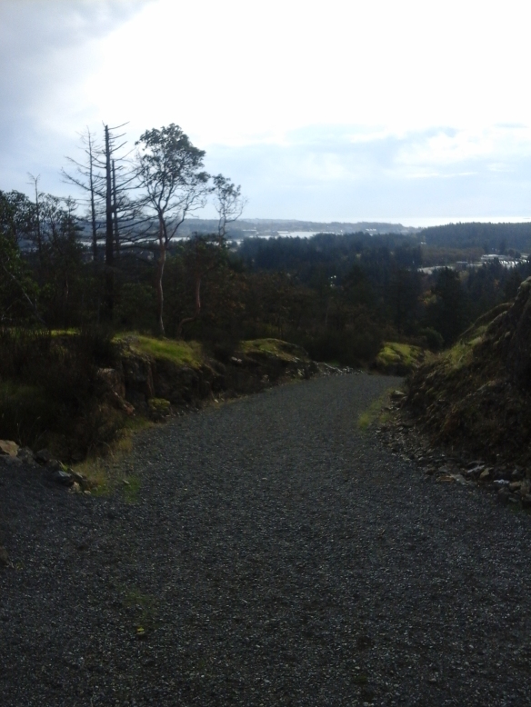
Mill Hill stands two hundred and two meters above sea level and has most of its parkland in City of Langford, B.C. Part of the park also lies within the Town of View Royal, B.C. This park is about seventy one hectares in size and encompasses a second growth forest of Douglas fir, arbutus and Garry oak trees. The terrain is mostly rocky and steep although Mill Stream flows through the southwestern edge of the park where its narrow flood plain lies. The Capital Regional District for British Columbia has administration over this parkland which hosts several buildings, used as headquarters, within a chain-linked fence area. There is limited access to this part of the park. The main parking area and trails are in Langford, B.C., where the formal trails, Auburn Trail and Calypso Trail, to the top of the hill skirt the south and western slopes. The Auburn Trail is the most direct route up to the summit and is about two thousand meters long. The gravel trail is wide and has several switchback sections though rocky Garry oak meadows. The meadows contain wildflowers that bloom in the spring. A minor trail, The Mill Pond Trail, is found a short distance along the Auburn Trail. This trail leads to the right and heads downward   toward a small pond and the playground at Crystalview elementary school (with separate write-ups). The Auburn Trails also passes through groves of arbutus trees near a rough rocky area just before the summit. You may notice that some rocks show signs of glacial striations. As this pathway was the original road to the fire watch tower keep an eye out for small paved sections. Near the summit the trail branches to the left and right. The left branch leads to the cairn and concrete foot posts of the fire tower while the right branch leads to a bench with a wooden platform that overlooks Esquimalt Harbour, Portage Inlet and the communities to the south. On a clear day Mount Baker in Washington State, USA, can be seen to the east and the Olympic Mountains to the south across the Strait of Juan de Fuca and the Salish Sea. Flowers that are found in this park include the common camas, white fawn lilies, tiger lilies and calypso orchids.

There are benches, a privy and picnic tables found near the parking lot.

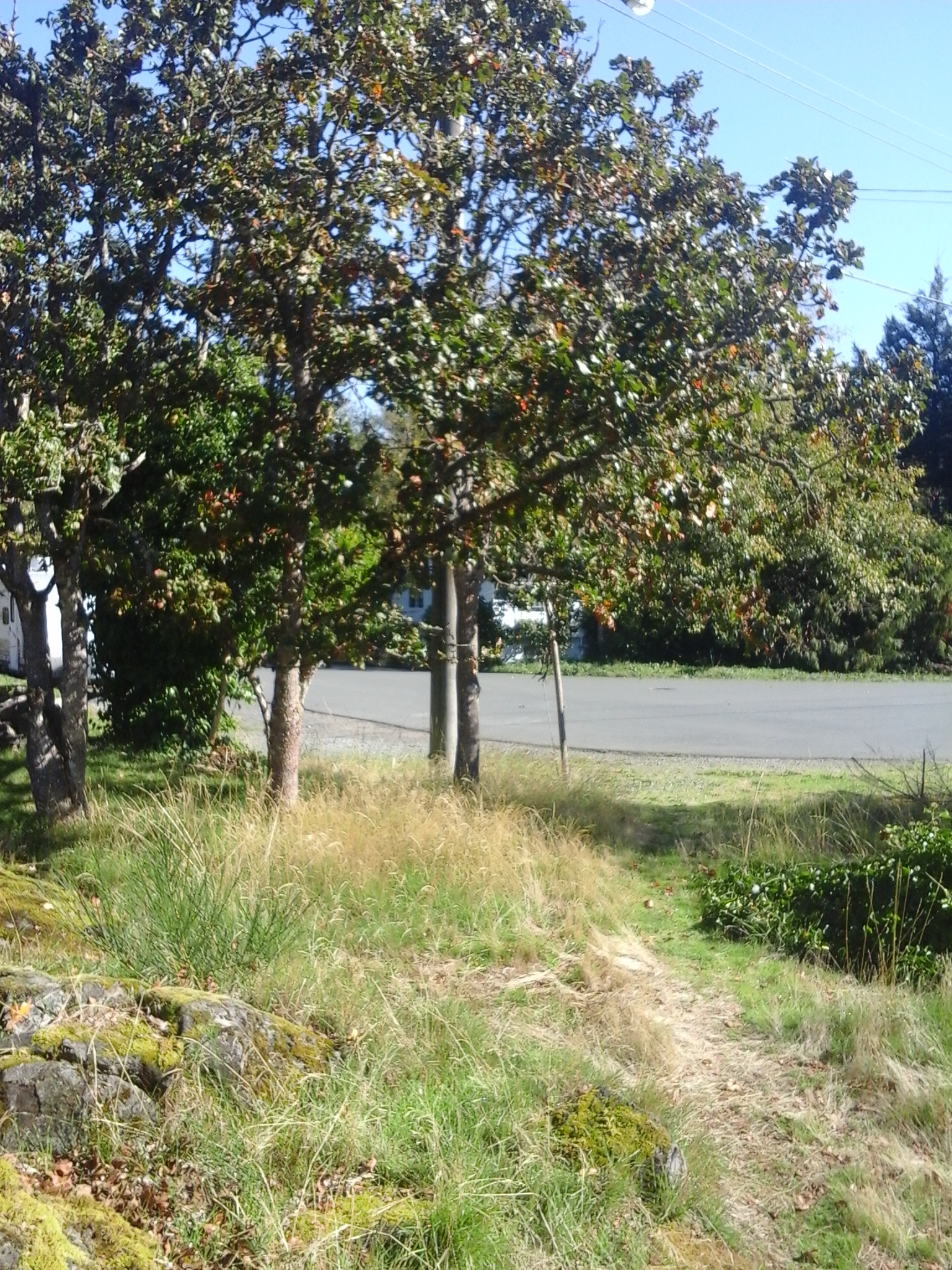
The Calypso Trail has three sections. A lower section, accessed from the parking lot, includes a route on the floodplain of Mill Stream while the upper section provides an alternative route down from the summit. This trail also continues down the northeast side of the hill with a trail access near Thetis Lake, which can be read about here (include link to page). The east side of the park is bordered by Edwards Park and several large private properties.

Geographical location N48° 27’ 10” W123° 28’ 55” parking lot; consult the CRD website for a map of the trails and facilities in the park

Mill Hill Regional Park can be accessed from the Trans Canada Highway, Hwy1. Exit onto the Island Highway and turn right onto Six Mile Road. Turn left onto Atkins Road and continue along to reach the park entrance on the right. There is a large gravel parking area near the park building’s chainlink fence. City buses travel along Atkins Road.

There are many articles and papers written about Mill Hill Regional Park.

Jeannie Park

Jeanine Park is in the Mill Hill neighborhood of Langford, B.C. At one third of a hectare, Jeanine Park has a grass covered area with a perimeter formed by cottonwood trees. This park borders along Hwy 1 and has a gravel footpath that extends along the highway right of way. The right branch of this footpath extends about fifty meters up a slight slope and onward to a small turnabout surrounded by western red cedar trees. The trail to left leads toward Cedarvale Park and Selwyn Cedarvale Green Space. This gravel and dirt trail divides again with the left side zigzagging down the slope of Mill Stream into Cedarvale Park while the right branches passes very close to Hwy 1 and eventually reaches Selwyn Road near the Kingdom Hall.

Geographical location N48° 27’26” W123° 29’ 12”

Jeanine Park can be reached from the Trans Canada Highway also called Hwy1. Turn at Veteran Memorial Parkway/Millstream Road and turn south. Take the first left onto Strandlund Avenue and continue to the left to stay on Strandlund Avenue. Follow the roadway then turn right onto Selwyn Road. Take the first left onto Mill Hill Road and then another left after crossing over the small bridge over Mill Stream. Turn left onto Jeanine Drive and continue along to reach the small white post that indicates the footpath beside the park. Jeanine Park is on the right. There is limited parking in this area.

Toth Park

Toth Park

Toth Park is in the Mill Hill neighborhood of Langford, B.C. This nature park has a rocky Garry oak meadow with a moss and lichen covered footpath under the branches of the small oak trees. This one tenth of a hectare park is surrounded by the fences of neighborhood homes in this quiet area. Cedarvale Park is nearby and makes for a nice walk along Strandlund Avenue then onto the trails in Selwyn Cedarvale Green Space.

Geographic location N48° 27’19” W123° 29’ 25”

Toth Park can be reached from the Trans Canada Highway also called Hwy1. Turn at Veteran Memorial Parkway/Millstream Road and turn south to head toward downtown Langford. Take the first left onto Strandlund Avenue and continue to the left to stay on Strandlund Avenue. At the junction with Duncan Place turn left. Take the next left onto Toth Place. Look for the footpath and parkland on the right at the sharp curve in the road There is limited roadside parking.

Mill Hill Regional Park

Mill Hill Thetis Lake Calypso Trail 5 Mill Hill Thetis Lake Calypso Trail 20

Mill Hill stands two hundred and two meters above sea level and lies within the parkland called Mill Hill Regional Park in View Royal, B.C. As a regional park since nineteen eighty, this park is kept by the Capital Regional District which has a large fenced yard with several maintenance buildings within the parkland. The main parking area and trails are in Langford, B.C., where the partially paved trail (an old fire road), called Auburn Trail, leads to the top of the hill. There are toilets and picnic tables near this parking area. The Auburn Trail skirts the south and western slopes. The east side of the park is within View Royal and is bordered by Edwards Park and several private properties. This northeastern slope of Mill Hill is accessed using Calypso Trail. The Calypso Trail, about two kilometer trail long, is a rough pathway along Hwy1 and becomes a woodland trail as it climbs to the summit to connect with Auburn Trail. Douglas fir, arbutus, western red cedar and garry oak trees are seen along the trail. Near the summit are several shallow wetlands, moss covered rocks and small meadow areas where big-leaf maple, red alder are seen. Salal, Oregon grape and other small shrubs are seen in the park. Near the junction of the two trails are the concrete foundation blocks of the nineteen fifty eight fire lookout tower. A rock cairn with brass direction location lines on its surface lies near the concrete blocks. Calypso Trail then continues to the parking lot down a steep section on the eastern side of the hill. The park has several ecosystems along its slopes although most have been modified over the past hundred years to meet the needs of the area. Along the lower northeastern section of the Calypso Trail, beside Hwy1, pick some Himalayan blackberries in the late summer. A stroll along the forested section of this trail, in the springtime, reveals the small wildflowers like camas, white fawn lilies and fairyslippers (Calypso bulbosa), the namesake of this trail. A visit to this seventy-one hectare parkland is worthwhile and easily explored as a walk in your backyard.

Geographical location N48° 27’ 10” W123° 28’ 55” parking lot

Mill Hill Regional Park can be accessed from the Trans Canada Highway, Hwy1, and is located at 490 Atkins Road. Exit from Hwy1 to reach the Island Highway and turn right onto Six Mile Road. Continue along Six Mile Road just after the Galloping Goose Trail overpass, turn left onto Atkins Road. The park entrance on the right is on the right and is along a curve of the road in this quiet urban neighborhood. A second road to the right provides access to the maintenance buildings that are within the chain-link fenced area of the park. A large paved parking area is near the park buildings while a much larger gravel area is within the fenced area. City buses travel along Atkins Road.

There are several documents on the ecosystems within Mill Hill Regional Park.

Chilco Cheam Green Space

Chilco Road GS

Chilco Cheam Green Space lies on the north side of Chilco Road near Cheam Road in View Royal, B.C. This is a protected area has two rock walls that form terraces beside part of the road. The upland area has arbutus, Garry oak and Douglas fir trees. Salal, ocean spray and Oregon grape plants are found in the understory of this small green space. The area lies to the northeast of Mill Hill Regional Park in the Chilco Neighborhood of View Royal. The Calypso Trail of Mill Hill Regional Park lies to the north of this green space. Edwards Park, Chilco Park, the Galloping Goose Trail, Thetis Lake Park, Nursery Hill Park, Garry Oak Meadows Park and Kelvin Grove Park are nearby.

Geographical location N48° 27’ 30” W123° 28’ 10”

Chilco Cheam Green Space can be accessed from the Trans Canada Highway, Hwy1. Exit onto the Island Highway and turn right onto Six Mile Road. Turn left onto Chilco Road, which is just past the overpass for the Galloping Goose Trail. Although this road continues start turn right on Chilco Road and follow as the road curves around the neighborhood, past Chilco Park. The park is near the junction with Cheam Road. There is limited roadside parking along Chilco or Cheam Road. City buses travel along Six Mile Road and Atkins Road.

Robin Hill Park

Robin Hill Park access betweeen homes 5 Robin Hill Park 2

Robin Hill Park is a rocky Garry oak area in View Royal, B.C. At one and a half hectares this park is mostly steep rocky outcrops of granite covered with thick beds of mosses, lichen and ferns. There are some large Garry oak and Douglas fir trees and several moss cover stumps in this park. It was selectively logged in the early twentieth century. Robin Hill Park borders along the paved walkway on Chilco Road, along the turn-a-bout of Kaleigh Avenue and between homes 42 and 27 Carly Lane. Robin Hill Park is immediately east of Edward Park. Tread with care along the trail, that includes several staircases and steps, in this parkland as there is much to be enjoyed. Mill Hill Regional Park, Edwards Park, Chilco Park, the Galloping Goose Trail, Thetis Lake Park, Nursery Hill Park, Garry Oak Meadows Park and Kelvin Grove Park are nearby.

Geographical location N48° 27’ 30” W123° 28’ 10”

Robin Hill Park can be accessed from the Trans Canada Highway, Hwy1. Exit onto the Island Highway and turn right onto Six Mile Road. Turn left onto Chilco Road, which is just past the overpass for the Galloping Goose Trail. Stay on Chilco Road and follow to the end. The park is at the end of the road on the right side of the trail. There is limited roadside parking along Chilco Road. City buses travel along Six Mile Road and Atkins Road.